Tracked shipping to the Netherlands for just € 7. Prices include 9% BTW and new EU € 3 customs duty. No hidden fees. 

Ship to
Netherlands
0
  • argentina
  • chile
  • colombia
  • españa
  • méxico
  • perú
  • estados unidos
  • internacional

Select your country

Americas

Europe

Rest of the world

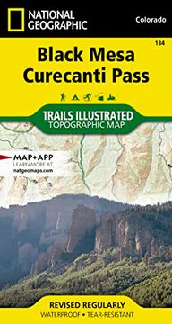
portada Black Mesa, Curecanti Pass map (National Geographic Trails Illustrated Map, 134)
Type
Physical Book
Language
English
Pages
2
Format
Paperback
ISBN13
9781566954303
Edition No.
2019th

Black Mesa, Curecanti Pass map (National Geographic Trails Illustrated Map, 134)

National Geographic Maps (Author) · Natl Geographic Society Maps · Paperback

Black Mesa, Curecanti Pass map (National Geographic Trails Illustrated Map, 134) - National Geographic Maps

New Book Imported to Netherlands
Delivery: 21 Jul - 24 Jul Shipping: 2 to 4 business days.
18,84 €
Import costs and 9% BTW included in the price ✅
18,84 €

Synopsis "Black Mesa, Curecanti Pass map (National Geographic Trails Illustrated Map, 134)"

- Waterproof - Tear-Resistant - Topographic MapOutdoor enthusiasts seeking to explore the remote and untamed mountains of western Colorado will marvel at National Geographic's Trails Illustrated map of Black Mesa and Curecanti Pass. Created in cooperation with the U.S. Forest Service, this expertly researched map covers the recreational land in the area with unparalleled detailed. Among the main points of interest are Gunnison National Forest, West Elk Mountains and Wilderness, Sapinero, Centennial and Gunnison State Wildlife Areas, Curecanti National Recreation Area and Rainbow Lake. Get off the beaten path and back on again by following the map along hiking and motorized trails; hard surface and mountain bike routes; and snowmobile and winter use trails. To aid in your navigation of the area, the map also includes contour lines, elevations, labeled peaks, summits and passes, water features and selected waypoints as well as a complete road network of the area, including numbered Forest Service roads and BLM routes. Some of the other recreation features pinpointed are areas for camping, cross-country and alpine skiing, climbing, fishing and picnicking. Additionally, wilderness regulations, survival tips, Leave No Trace guidelines and essential contact information is provided.Every Trails Illustrated map is printed on "Backcountry Tough" waterproof, tear-resistant paper. A full UTM grid is printed on the map to aid with GPS navigation.Other features found on this map include: Gunnison National Forest, West Elk Mountains, West Elk Peak, West Elk Wilderness.Map Scale = 1:40,680Sheet Size = 22" x 32"Folded Size = 4" x 7.5"

Customers reviews

Frequently Asked Questions about the Book

All books in our catalog are Original.
The book is written in English.
The binding of this edition is Paperback.

Questions and Answers about the Book

Do you have a question about the book? Login to be able to add your own question.

Opinions about Bookdelivery

More customer reviews