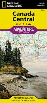
- Waterproof - Tear-Resistant - Travel MapNational Geographic's Canada Central Adventure Map provides global travelers with the perfect combination of detail and perspective in a highly functional travel tool. The map includes the locations of cities and towns with a user-friendly index, a clearly marked road network complete with distances and designations for roads/highways, plus secondary routes for those seeking to explore off the beaten path for destinations between Alberta and Ontario. Hundreds of points of interest and diverse and unique destinations are highlighted including World Heritage sites, national and provincial parks, bird sanctuaries, archeological sites, ski areas, hot springs, museums, and more. Whether you are staying in the Polar Bear capital of the world on Hudson Bay, visiting Ontario's award-winning wine region, or sitting beside a campfire in Algonquin Provincial Park, this map will prove a valuable resource in your travels. On the west side of the print map, explore the diverse landscape of Manitoba, bordered by Ontario to the east, the arctic coastline of the Nunavut Territory to the north, and the U.S. states of North Dakota and Minnesota in the south. Saskatchewan, where you are never far from lake or river recreational opportunities, lies directly to the west, bordered by the prairie province of Alberta and the state of Montana. The adventure continues on side two, heading to the extreme north with the untouched Labrador Peninsula and Inuit culture of Nunavut. Cross the James Bay to explore the many provincial parks of Ontario, or journey south to the maple hills and lakes of the Algonquin Upland. Every Adventure Map is printed on durable synthetic paper, making them waterproof, tear-resistant and tough -- capable of withstanding the rigors of international travel.Map Scale = 1:2,100,000Sheet Size = 25.5" x 37.75"Folded Size = 4.25" x 9.25"