Hallo! Tracked shipping to Netherlands with Delivery Duty Paid for just €7 

Ship to
Netherlands
0
  • argentina
  • chile
  • colombia
  • españa
  • méxico
  • perú
  • estados unidos
  • internacional

Select your country

Americas

Europe

Rest of the world

portada Geospatial Information Technology for Emergency Response
Type
Physical Book
Publisher
Language
English
Pages
394
Format
Paperback
ISBN13
9780367387792
Edition No.
1

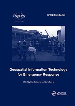
Geospatial Information Technology for Emergency Response

Sisi Zlatanova (Editor), Jonathan Li (Editor) (Author) · Crc Press · Paperback

Geospatial Information Technology for Emergency Response - Sisi Zlatanova (Editor), Jonathan Li (Editor)

New Book Imported to Netherlands
Delivery: 16 Sep - 18 Sep Shipping: 6 to 7 business days.
€ 123,06
Import costs and 9% BTW included in the price ✅
€ 123,06

Synopsis "Geospatial Information Technology for Emergency Response "

Disaster management is generally understood to consist of four phases: mitigation, preparedness, response and recovery. While these phases are all important and interrelated, response and recovery are often considered to be the most critical in terms of saving lives. Response is the acute phase occurring after the event, and includes all arrangements to remove detriments and a long-term inventory of supplies to deal with irreversible damage. The timely provision of geospatial information is crucial in the decision-making process, and can save lives and rescue citizens.The aim of this volume is to share technological advances that allow wider, faster and more effective utilization of geospatial information in emergency response situations. The volume describes current accomplishments and challenges in providing geospatial information with these attributes, and is organized in six parts: - Practice and legislation, with a focus on the utilization of geospatial information in recent disaster events, as well as resulting legislative attempts to share and access data.- Data collection and data products.- Data management and routing in 3D.- Emerging technologies, including positioning, virtual reality and simulation models.- Integration of heterogeneous data.- Applications and solutions.This volume is aimed at researchers, practitioners and students who work in the variety of disciplines related to geospatial information technology for emergency response, and represents the very best of current thinking from a number of pioneering studies over the past four years.

Customers reviews

Frequently Asked Questions about the Book

All books in our catalog are Original.
The book is written in English.
The binding of this edition is Paperback.

Questions and Answers about the Book

Do you have a question about the book? Login to be able to add your own question.

Opinions about Bookdelivery

More customer reviews