Hallo! Tracked shipping to Netherlands with Delivery Duty Paid for just €7 

Ship to
Netherlands
0
  • argentina
  • chile
  • colombia
  • españa
  • méxico
  • perú
  • estados unidos
  • internacional

Select your country

Americas

Europe

Rest of the world

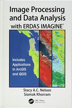
portada Image Processing and Data Analysis with Erdas Imagine(r)
Type
Physical Book
Publisher
Year
2018
Language
English
Pages
350
Format
Hardcover
ISBN13
9781138034983
Edition No.
1

Image Processing and Data Analysis with Erdas Imagine(r)

Siamak Khorram (Author) · Stacy A. C. Nelson (Author) · CRC Press · Hardcover

Image Processing and Data Analysis with Erdas Imagine(r) - A. C. Nelson, Stacy ; Khorram, Siamak

New Book Imported to Netherlands
Delivery: 14 Sep - 16 Sep Shipping: 4 to 5 business days.
€ 222,36
Import costs and 9% BTW included in the price ✅
€ 222,36

Synopsis "Image Processing and Data Analysis with Erdas Imagine(r)"

Remotely sensed data, in the form of digital images captured from spaceborne and airborne platforms, provide a rich analytical and observational source of information about the current status, as well as changes occurring in, on, and around the Earth's surface. The data products, or simply images processed from these platforms, provide an additional advantage in that geographic areas or regions of interest can be revisited on a regular cycle. This revisit cycle allows geospatial analysts and natural resource managers to explore changing conditions over time.Image Processing and Data Analysis with ERDAS IMAGINE(R) explains the principles behind the processing of remotely sensed data in a simple, easy to understand, and "how-to" format. Organized as a step-by-step guide with exercises adapted from original research and using publicly available imagery, such as NASA Landsat, ESA Sentinel-2, Orthophotos, and others, this book gives readers the ability to quickly gain the practical experience needed to navigate the ERDAS IMAGINE(R) software as well as learn certain applications in Esri's ArcMap ArcGIS for Desktop software and Quantum the GIS (QGIS) open source applications package. It also helps readers to easily move beyond the information presented in this book and tackle more advanced skills.Written by two professors with long experience in remote sensing and image processing, this book is a useful guide and reference for both undergraduate and graduate students, researchers, instructors, managers, and agency professionals who are involved in the study of Earth systems and the environment.

Customers reviews

Frequently Asked Questions about the Book

All books in our catalog are Original.
The book is written in English.
The binding of this edition is Hardcover.

Questions and Answers about the Book

Do you have a question about the book? Login to be able to add your own question.

Opinions about Bookdelivery

More customer reviews